 |
| Part 2 - Where the weather got better (and also worse) |
(This follows from part 1)
Day 4 Kylesku – Suilven
In the morning the sun is actually shining. I filter some water and have a wash in the
river, then as I sit down to make coffee, I notice a tiny tic on my leg then
another and another. No word of a lie, I pull sixteen (16!) tics out of my
leg while making coffee- gross!
The suns out though and I’m in a good mood because today,
after 3 days in the wilderness, there will be cafés. In fact there is a high
potential that today will be a two café day – these are the best days. We roll
along to Drumbeg stores and do a quick supermarket sweep to gather snacks for the day. Then it’s into the Secret Garden tea room for coffee cake and sandwich. Yum.
|
|
Cafe 1: I'd basically eaten it all before I thought to take a photo
|
 |
| First views of Suilven |
From there it’s on towards Lochinver, the route takes us
over the coast path and we get some stunning views overlooking west coast
beaches. (Note to self – must return soon). We also get our first glimpses of
Suliven pushing up into the distant horizon. Soon we drop in to Lochinver; I know
it’s a heresy but I don’t really like pie and Caroline’s a vegan so we bypass
the famous pie shop and head to a café near the outdoor store at the other end
of town. Feeling so deficient in vegetables I actually order a salad (and a hot
chocolate obvs).
 |
| West coast beaches in the sun... |
We stock up on dehydrated meals and pop to the spar where
Caroline buys all the avocados in sight. As we’re leaving Lochinver the sun disappears
behind a cloud and yet again we find ourselves being pelted by hail.
 |
| Suilven, its getting closer |
I’ve been excited to ride the next section since we started
planning this trip. The road past Suilven. This crazy, not-quite-munro, ridge rises straight up out of the ground, like a sort of Jurassic Park landscape. The track in proves to be much more ride-able
than expected, we’re zooming along past walkers finishing their hike in the
other direction. We are making great time, perhaps we’ll camp near Oykell Bridge
to catch breakfast in the hotel (second time lucky).
 |
| About where the good path ended |
We pass the turn off to climb the ridge, and continue on the
path use by walkers approaching from the (less popular) eastern route. The
path quickly detoriates. We’re about 10km from the road but our pace
slows to 3kph, and the path shows no sign of improving. For about 3 hours we
push the bikes. Eventually we reach Cam Loch and pedal along the loch shore. We’ve
been going almost 10 hours and we’re not going to get to Oykell tonight after
all, but we do have a pretty epic view from our camp spot.
 |
| Cam loch - Eventually |
 |
| Sunset over Suilven |
Day 5 Suilven – Ullapool
I wake up feeling like I didn’t sleep at all. Turns out any
time I was sleeping, I was also snoring and Caroline hasn’t slept either. Oops.
I’m a bit embarrassed, normally
I’m the one moaning at the snorers!
 |
| View from my tent |
We ride the path from the loch down to the road, but the
time we hit the road it’s raining again and the wind has picked up. Always with
the head wind. Seriously.
We ride alternating peloton again for about an hour to get
ourselves back to Oykell Bridge. The bar
isn’t technically open, but some bedraggled cape wrath walkers have arrived
just before us. We shuffle in behind them. I huddle against the radiator and
snaffle a bacon roll.
 |
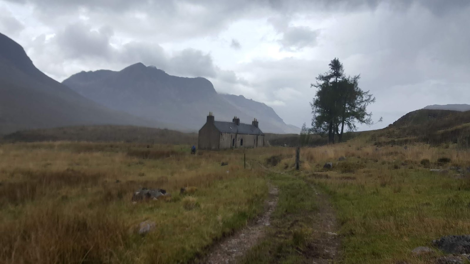
| Schoolhouse Bothy |
Pretty confident we’re going to get to Ullapool this
afternoon, we use the wifi to book into a B&B. We’ll need to stock up on
supplies there anyway, so we’ll treat our selves to real beds and dry
everything out. We’re excited about the café potential in Ulapool – Caroline
starts to fantasize about avocado sandwiches. I tell her this is a terrible
idea, if you get exited about a specific meal, it won’t
be on the menu…
 |
| Steep drop to the left not a place to fall off. |
Climbing out of Oykell bridge it’s raining again (no-
really?) and we stop in at Schoolhouse bothy chat to walkers sheltering in
there. On we ride, passing the Corriemulzie estate lodge. We bump into a guided group, lead by one of the estate rangers. He
confidently, tells us there is absolutely definitely no way through to Ullapool
on this track. He’s wrong. I know this, but it doesn’t stop me worrying, just a
little bit.
 |
| "No more hills between us an Ullapool" |
Carloine’s done the next bit before as a coast-to-coast
ride. she’s confident that we’ve it’s basically flat to Ullapool from here. Of course when she did it before, it wasn’t
on the HT550 route, which never misses a chance to go up a hill if at all
possible. Sure enough shortly before Ullapool the route sends us off the main track and
onto a short steep climb up hill overlooking the village.
 |
| Single track above Ullapool - worth the climb |
It’s stopped raining (ish), the clouds lift and we get a
view into Ullapool. Beds, cafes, and showers await – how exciting. We drop into
town through a nice single track descent, it’s a hidden gem flowing through the
gorse bushes.
 |
| Ullapool. There it is! |
We pull up at the first café we find. Caroline’s been
talking all morning about the avocado sandwich she’s going to order. Of course there’s no avocado on the café menu. A bigger person wouldn’t say ‘I told you so’,
I’m not a big person.
 |
| Mmmm real food |
We find our B&B stuff our shoes with newspaper, hang
everything on the radiators and head to Tescos. After 5 days of limited choice, the selection is a bit overwhelming. True to form, at the checkout I have a
basket of chocolate and sweets, and Caroline has a basket of avocados and nuts. It’s
then off to the pub for a real meal (the joy!) and back to the B&B for a
proper sleep (more joy!).
Day 6 Ullapool -Fisherfield
 |
| Leavng Ullapool |
After a delicious breakfast, we’re off cycling down the A835
out of Ullapool, this is likely to be A Big Day. The views down Loch Broom
behind us are spectacular, the views of mountains ahead tell us we’re
probably going too be climbing again soon.
 |
| To the coffin road! |
At the end of Loch Broom, we spy a sign for the coffin road.
This is another notoriously difficult section but the sun is out and I’m
feeling ready. The path essential travels 400m straight up and shoots us out onto a
plateau. Those coffin carriers treading this path must surely have dropped a
coffin or two!
 |
The Coffin Road- up up up
 |
| Loch Broom views |
|
The weather closes in and we drop into Dundonnel through a
steep descent. I’d hoped for a café on
this short stretch of road, but alas no. The An Teallach massif rises ahead, and I
feel like there ought to be some sort of dramatic music to frame the scene. The up and over ride is just lovely, although
ominous storm clouds are gathering behind us. We’re dropping into the valley
with the Shenavall bothy though, and if we time this just right we’ll hit the
bothy just as rain comes.
 |
| Looking out to An Teallach |
 |
| Dropping in to Strath na Sealga valley |
We pedal on. I can see the bothy ahead just as the first few
drops hit my helmet. We’re going to be able to shelter out the storm, I feel a
bit smug. I ride quickly to the building, it’s got a sign outside ‘Danger
Unsafe Building’. With a sinking feeling I read the sign underneath ‘Shenevall
Bothy 3km’ **** !! We alternately push and ride our bikes into the driving
rain. The path becomes part bog, part river. Just as we finally reach Shenevall
the rain eases off, typical.
Next up is the Strath na Sealga river crossing, it’s the
biggest river crossing on the route. We
cross right at the loch shore, it’s maybe 20m across. While we’ve had several
days of rain it’s been an unusually dry winter so river levels are mercifully low,
we manage to keep our knees dry.
 |
| Strath na Sealga crossing |
3 weeks of continuous rain later, the racers will pass
through to waist deep levels (hardcore).
River crossing safely negotiated, we begin the up and over
through Clach na Frithealsidg, the ascent is so sharp not all the contours are
marked on the OS. I push the bike up, hold the brakes and take a couple
of steps forward. I repeat this for process many times over in worsening
weather. The cloud closes in and visibility drops. I keep my Garmin running to
make sure I don’t miss the path. We’re pretty close to the furthest point in
the UK from a road – this would be a bad time to get lost.
 |
| Climbing up into the rain |
Just as I crest the top Caroline pops out from behind a rock-
in poor visibility, best stick together. We’re soaked through and shivering. In
fact I’m wearing the same clothes I rode for the Strathpuffer, 5 months earlier,
but feeling much much colder than I did in Janurary!
 |
| And then freaking snow! |
Pretty soon, the rain becomes snow and then a bit more snow.
We hurriedly pedal across the top, thank goodness it’s ride-able, the sooner we
can descend out of the weather the better. I want to stop
an take some photos of the blizzard, but we need to focus on keeping moving. After
what feels like an ages (but is actually about 20 mins) of riding in snow, we
reach the edge of the plateau. It’s a
steep steep path down, on another day it would be a nice descent but with
frozen fingers and no dropper post, we run/skip/walk down the first part.
 |
| Views into Fisherfield - stunning |
Soon we drop out of the clouds and the Fisherfield causeway
stretches out beneath us. A solid minute of wooping ensues. We can see the
cause way is easily passable and we can see the route down to it is ride-able and
we can see the bothy at the bottom where we’ll stay tonight.
 |
Carnmore Bothy sign a welcome sight!
📷 Caroline |
The bothy is pretty basic it’s a dirt floor and dry stone
walls, but it’s dry and considerably warmer than outside. There’s a small group
of munro baggers prepping for a big day in the hills tomorrow. I attempt to discreetly
change out of my soaking clothes. While we exchange chatter about how wrong all
the weather forecasts have been.
 |
| Grateful to be sleeping in the dirt |
In the evening the weather clears up and I'm treated to a glorious sunset as I nip out to for a cheeky nature poo. I make up my hot water bottle and climb into my sleeping bag. The bothy might be basic but we’re out of the weather and I’ve never been more grateful to sleep on the dirt.
 |
| Sunset at Fisherfield - lovely |
 |
| Fisherfield mountains |
Day 7 Fisherfield – Kinlochewe
 |
Creepy bothy skull, (Caroline made
me move this outside last night) |
I wake up and stretch, the walkers have long gone presumably
heading off at sunrise like they planned. After yesterday we deserve a
leisurely morning. I stick my head outside the bothy and the sun is shining and
it’s a blue sky. Yes. After a week of miserable weather finally some summer!
 |
| Dry All the Things. |
We lay out all the wet stuff outside in the sun in the vain
hope of drying things out a bit. Eventually we set off, our first action is
crossing the causeway, we faff about taking photos.
 |
| Fisherfield photo ops |
 |
| Caroline on the causeway |
I’m a bit nervous about the next bit, we’re heading on to the infamous ‘postmans path’, If my reading is right we should be in for a day of moving at 1mph carrying our bikes over fallen trees and generally having a tough time.
So I’m a little bit confused that we’re peddling along some fairly
lovely single track. It’s mostly quite flowy and with beautiful views. We double
and triple check the Garmin, we’re on the route. So where is the dreaded
postmans path? As it turns out there are several variants on the HT550, and
while the race route goes onto the postmans path, the route we downloaded
detours round the other side of Loch Maree via Poolewe.
 |
Fun and Sun. Happy days
|
By the time we realise this it’s too late to turn around. The
Postmans path will remain a mystery for another time. I’m a bit glad and a bit
sad. The path from Fisherfield to
Poolewe is a really nice ride -when I come back to do the Fisherfield Munros I’ll
probably bike in this way. It would have been nice to complete all the hardest
sections though we could really use some easier riding.
 |
Leaving the mountains
|
Another benefit of heading via Poolewe is *Café time*, If you
find yourself up this way I can highly recommend the hot chocolate in Bridge Café.
We now need to think about how we finish the trip. We have to get back to the
van in Garve tomorrow, the next part of the route takes us onto the Slatterdale
ride. We’ve both ridden this before although I don’t remember much about it.
Caroline’s not very keen to ride it but I really want to and persuade her to
continue.
 |
| Bridge cafe Chocolate 😋 |
We push our bikes up the Toille path and then mostly push
them down again. Caroline was 100% right, this was not a good idea. We finished
the Slatterdale ride and I feel really tired I stop and have a micro sleep on my
handle bars and keep on the road ride to Kinlochewe.
 |
| Puncture fixing |
Caroline arrives first and is greeted by a policeman closing
the road due to a bad accident with a biker on the road. Just as she is
starting to panic that I’m the biker, I pedal up to them. Turns out there had been a bad crash with a
motorcyclist. We drop in to the pub in Kinlochewe, there’s a big sign outside
saying they’re fully booked for dinner, but we stop in for drinks anyway. As we
eat all the crisps in the bar, the barman tells us they’ve had a cancellation
and we can stop for dinner YASS!
 |
| Kinlochewe camp spot |
After dinner we find an out of the way spot and camp for the
night. I still wake up with frost on my tent, but the continuing clear skies mean
it hasn’t rained in last 24 hours.
Day 8 Kinlochewe – Garve
 |
| Back to the van time |
After a leisurely breakfast in the Kinlochewe café, (MMmm French
toast and berries) we begin the 30mile road stretch back to Garve. The suns out
and the winds died down, we roll gently back to the van reflecting on the epicness
of the last week.
 |
| Our HT550 experience: wild wet but wonderful |


No comments:
Post a Comment